Garmin GPSMAP 78S
 | Expecting restock 14 560 ₴ Wearable all-weather GPS navigator. A convenient strap is attached to the case, for wearing on the arm. The device is very economical, one set of two AA batteries is enough for at least 20 hours of continuous operation. True, if you use a magnetic compass or at night you need a screen backlight, then the operating time can be significantly reduced. Additional options include a barometric altimeter. The case is protected from moisture. |
Close
We recommend products in stockSat Navs Garmin →

handheld, 2.6 ", влагозащита IPX7, non chargeable batteries, up to 16 hours of work, 260 g


handheld, 2.6 ", memory 8 GB, влагозащита IPX7, non chargeable batteries, up to 16 hours of work, 159 g
Garmin GPSMAP 78S
Type:handheld
Screen size:2.6 "
Resolution:160х240 px
Power supply:non chargeable battery
Working hours:up to 20 h
Weight:218 g
Wearable all-weather GPS navigator. A convenient strap is attached to the case, for wearing on the arm. The device is very economical, one set of two AA batteries is enough for at least 20 hours of continuous operation. True, if you use a magnetic compass or at night you need a screen backlight, then the operating time can be significantly reduced. Additional options include a barometric altimeter. The case is protected from moisture.
All specifications
Specifications GPSMAP 78S
|
| |||||||||||||||||||||||||||||||||||||||||||||||||||||||
Information in model description is for reference purposes.
Before buying always check characteristics and configuration of product with online store manager
Catalog Garmin 2024 - new products, best sales and most actual models Garmin.
Before buying always check characteristics and configuration of product with online store manager
Catalog Garmin 2024 - new products, best sales and most actual models Garmin.
Series Garmin GPSMAP (tracking)Compare using chart →

handheld, 3 ", memory 16 GB, Wi-Fi, ANT+, влагозащита IPX7, up to 180 hours of work, 230 g


handheld, 2.6 ", memory 16 GB, ANT+, влагозащита IPX7, non chargeable batteries, up to 16 hours of work, 217 g

handheld, 3 ", memory 16 GB, Wi-Fi, ANT+, влагозащита IPX7, up to 180 hours of work, 230 g

handheld, 3 ", memory 16 GB, Wi-Fi, влагозащита IPX7, non chargeable batteries, up to 16 hours of work, 230 g

handheld, 2.6 ", memory 16 GB, ANT+, влагозащита IPX7, non chargeable batteries, up to 16 hours of work, 217 g

handheld, 3 ", memory 16 GB, Wi-Fi, ANT+, влагозащита IPX7, up to 36 hours of work, 230 g

handheld, 3 ", memory 16 GB, Wi-Fi, ANT+, влагозащита IPX7, up to 35 hours of work, 230 g

handheld, 3 ", memory 8 GB, влагозащита IPX7, non chargeable batteries, up to 19 hours of work, 282 g

handheld, 3 ", memory 4 GB, Wi-Fi, ANT+, влагозащита IPX7, up to 18 hours of work, 272 g
handheld, 2.6 ", влагозащита IPX7, non chargeable batteries, up to 16 hours of work, 260 g

handheld, 2.6 ", влагозащита IPX7, non chargeable batteries, up to 18 hours of work, 203 g

handheld, 3 ", memory 16 GB, Wi-Fi, влагозащита IPX7, non chargeable batteries, up to 16 hours of work, 230 g

handheld, 3 ", memory 4 GB, Wi-Fi, ANT+, влагозащита IPX7, up to 40 hours of work, 272 g
0 1 3 5 |
I love tourism, long hikes and everything connected with them. And in recent years, I fell in love with "water trips" in kayaks. I have like-minded friends and the time we spend outdoors together is the best outdoor activity I can imagine. Unfortunately, my wife does not share my hobby, but she treats it with understanding. This navigator was her birthday present to me and I must say that the gift was a success. She once heard in a conversation that such a device was needed and tried to find the most versatile, all-weather and durable device. It already has high-quality pre-installed maps, including a map of Ukraine. The functionality for the tourist is simply fabulous. Thanks to the highly sensitive GPS-receiver determines the coordinates quickly and very accurately. It has a built-in tilt-compensated 3-axis electronic compass and a barometric altimeter. It can quite accurately determine the distance traveled, measures the speed of movement, and can calculate the height of the ascent and descent. Has excellent protection against water according to the IPX7 standard. Why is there protection, it can be thrown into the water, where it will swim and continue to work quietly. The only thing you definitely shouldn’t do with it is immerse it to a noticeable depth. It's not designed for water pressure though. Very economically consumes the charge of batteries (two finger-type, AA format), which is enough for almost a day of continuous operation. And if the batteries are discharged, they can be replaced with any compatible batteries (preferably alkaline). Does not work with Glonass satellites. The screen is small and dim. It looks unpresentable in the sun, but at least it is readable and that's good. The weight is significant. Very high cost. Thanks to my wife (she earns decently), I myself would hardly have spent so much on such a device. |
1 out of 9 user review(s) shown
8 more user review(s)
Video reviews

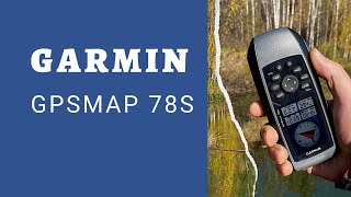
Garmin GPSMAP 78s. Обзор GPS навигатора Garmin 78s.
4 March 201451 483 view
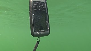
GARMIN GPSMAP 78s. ПОДВОДНЫЕ ТЕСТЫ
22 June 20154 311 view
Garmin GPSMAP 78S Russia
13 October 2020692 view

Обзор навигатора GARMIN GPSMAP 78S
7 August 201717 904 view

Анти-Обзор Garmin GPSMAP 78S
14 January 20154 315 view

Комплект карт на Garmin GPSMAP 78s. Отзыв клиента
4 March 20201 631 view

Garmin 78sc Review
17 November 201920 372 view
Garmin GPSMAP 78s
18 April 2020669 view
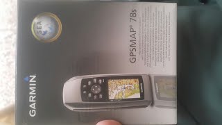
Garmin GPSMAP 78s Unboxing HD (010-00864-01)
22 May 20185 369 view

Garmin GPSMAP 78sc Marine Handheld GPS - West Marine Quick Look
3 January 201877 119 view
Additional features sat nav Garmin GPSMAP 78S:
- Hunter/Angler Calendar
- Sunrise and sunset information and moon phases
- Tide Table
- Area calculation
- Photo navigation
- Garmin GPSMAP 78s — 3-axis electronic compass with tilt compensation; barometric altimeter (altimeter); data transfer between similar devices.
- Wrist strap
- USB cable


